• Beautiful Trails!

    Epic landscapes and

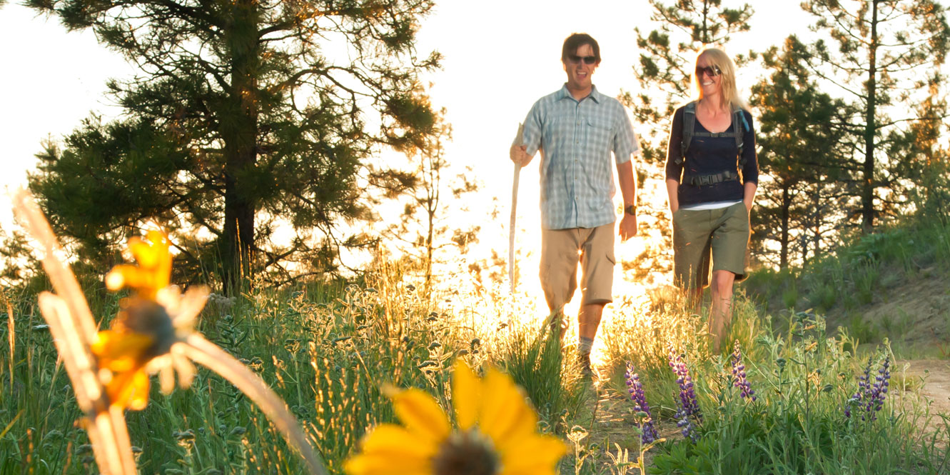
Hiking in Lake Chelan

Okanogan-Wenatchee National Forest, Chelan Ranger District.

The Chelan Ranger District contains 422,000 acres surrounding the middle and upper lake reaches of Lake Chelan. Fourteen major trailheads provide starting points for 250 miles of maintained summer trails. Trails in the back-country include over 60 miles of varied terrain north and south of Lake Chelan. These trails are open to motorcycles, horses, mountain bikers and hikers. The remaining 190 miles of summer trails are non-motorized.

Within the Glacier Peak and Lake Chelan-Sawtooth Wilderness Areas, trails are open to hikers and most sections are also open to horses and similar stock animals. Within the Glacier Peak Wilderness the group size for hiking, riding and camping is limited to 12 heartbeats, including stock animals. Echo Ridge Summer TrailsWithin the Lake Chelan-Sawtooth Wilderness the group size is limited to 12 people and up to 18 head of stock. Trail opportunities are many. They range from short day hikes near Chelan, Lucerne Landing and Holden Village areas, to overnight trips across the high elevation Summit Trail with its pristine alpine lakes and cirques sprinkled over the Lake Chelan-Sawtooth Mountain Range.

The Pacific Crest Trail travels down the Agnes Creek Trail’s old growth alley and also serves as the connection between the Mount Baker-Snoqualmie National Forest and the North Cascades National Park’s Lake Chelan National Recreation Area. Motorcycle enthusiasts love both riding to the high alpine lakes to the north of the lake, and the exciting terrain of the Devil’s Backbone Trail.

For more information on finding the right trail for your next adventure, contact the Chelan Ranger District.

Get Popular Trail Maps!
View all Hiking!

Trails & Epic Landscapes

Echo Ridge Summer Trails (Length: 25 miles)
The Echo Ridge Trail System contains almost 25 miles of trails intertwined with roads. Originally designed for Nordic skiing and snowshoeing in the wintertime, hiking and mountain biking are popular activities spring through fall on Echo Ridge trails. There are wide, easy trails suitable for all ages, and highly technical single track trails for the more adventurous. You will travel over open ridge tops through a young, emerging forest recovering from a 1968 wildfire. Expect to see great views of Lake Chelan, the Stewart Range, Okanogan Highlands, and Columbia Plateau. Trail difficulty varies from “easy” trails to “most difficult,” but most trails are suitable for children.

Driving directions: From Chelan travel west on Highway 150 (Manson Highway) toward Manson for 1.5 miles. Turn right on Boyd Road and follow signs to the Echo Ridge Nordic Ski Area, nine miles from Chelan.

Pot Peak (Length: 9.5 Miles)

A real workout! It’s only four miles to the top of Pot Peak from Snowberry Bowl campground, but it’s steep enough to make you feel it. Take plenty of water and a hiking stick.

Driving directions: Approximately 30 minute drive from Chelan How to get there: From Chelan take Highway 97A south 4 miles to South Shore road. Continue west on South Shore to 25-Mile Creek area. Take Shady Pass Road (FS #5900) to Slide Ridge Road (FS #8410). Park at Pot Peak Trailhead.

Devil’s Backbone (Length: 13 Miles)

This trail gives day hikers several options. You can be dropped off at either the Stormy Mountain, Windy Saddle or Crescent Hill trailheads, or you can hike along the Devil’s Backbone to the Crescent Hill or Pot Peak trailheads. One popular route is to get dropped off at the Stormy Mountain trailhead, and hike back to Snowberry Park via the Devil’s Backbone and Pot Peak trails. Hiking the whole length of Devil’s Backbone requires transportation at both ends. This trail traverses the crest of Devil’s Backbone from the trailhead on Stormy Mountain Road (FS #8410). There are outstanding viewing opportunities along the trail. Campsites and water are located at Handy Springs, just off the Shady Pass Road (FS# 5900), and at Windy Camp just north of the trailhead on Stormy Mountain Road.

Driving directions: From Chelan take Highway 97A south toward Wenatchee 4 miles to South Shore road. Continue west on South Shore to 25-Mile Creek area. Take Shady Pass Road (FS #5900) and continue up 15 miles to junction of Spur Road and Crescent Hill trailhead. Not suitable for passenger cars. (Approximately 2 hour drive from Chelan).

Stormy Mountain (Length: 1.5 Miles)

Bring a picnic lunch for this scenic drive and 1.5-mile hike. Great for families, as this top-of-the-world hike is not long, but will give you a workout due to the elevation. You will have earned a fantastic view when you reach the top of Stormy Mountain. Open ridge, 6500-7200 elevation.

Driving directions: A little over 1 hour drive from Chelan How to get there: From Chelan take Highway 97A south 4 miles to South Lakeshore Rd. Continue west on South Shore to 25-Mile Creek area. Take Shady Pass Road (FS #5900) to Slide Ridge Road (FS #8410) fifteen miles to trailhead. Not suitable for passenger cars.

Riverwalk Park Loop Trail (Length: 1 Mile)

This is a one-mile pathway that loops between the two bridges that span the Chelan River, in Historic Downtown Chelan. There are shaded benches all along the trail. It is a perfect place for a walk or jog. You can also fish the Chelan River in season, and bird watching is popular at this spot.

How to get there: The trail is part of the park adjacent to the main business district of Chelan. Access points along the trail include Columbia at Woodin, Wapato at Emerson and Okanogan at Emerson.

Chelan River (Reach 1) Trail (Length: 3 Miles)

This is a 3-mile-plus roundtrip walk that overlooks like Chelan Dam and the Chelan River. It takes visitors from the Riverwalk Loop Trail in downtown Chelan to Reach 1 of the Chelan River – the uppermost section of the 4-mile river that flows down to join the Columbia River and Chelan Falls. This trail was built by Chelan County PUD to enhance community recreation as part of its federal license to operate the Lake Chelan Hydro Project. The first section of the trail begins in Chelan, at the boat launch on the south side of the Chelan River.

This half-mile section is paved and accessible to all. Along this part of the trail, visitors will learn about the Chelan Dam, which provides enough clean, renewable hydropower to supply about 30,000 average Northwest homes. Interpretive signs also explain the power tunnel (or penstock), an underground pipe, 14-feet in diameter, which draws water from the lake at the base of the dam and carries it to a powerhouse two miles away at Chelan Falls. The lower section of the trail, 1.1 miles long, is gravel and winds through the natural riverbanks.

Visitors will enjoy learning about the American Indian Tribes that inhabited the Chelan Valley, the wildlife in the various reaches of the Chelan River and about the unique geology where basalt cliffs form a treacherous, narrow gorge for the river as it nears the Columbia. Please respect wildlife and the natural surroundings as you enjoy the Reach 1 Trail.

How to get there: Begins at Riverwalk Park Boat Launch

Beebe Springs Wildlife Area (Length: 4.4 Miles)

Beebe Springs Wildlife Area covers 207 acres with 1 mile of Columbia River shoreline riparian, wetland, upland shrub steppe, and cliff/talus habitats. Beebe Springs Creek meanders through the eastern portion of the property. Extensive habitat restoration began on the area in 2005 and will continue for several more years.

How to get there: From Chelan, 3 miles east on Highway 150 to junction with Highway 97. North on Highway 97 0.3 mile to parking area.

Little Bear Trail (Length: 2.3 Miles)

Little Bear Trail at Lake Chelan State Park is a 2.3-mile loop hiking trail in a previously closed portion of the park. The trail begins between the trailer area restroom and campsite number 22 and travels to the underground highway crossing and then up into the forest overlooking the lake. Lake Chelan State Park Trail runs along the water’s edge through the 127-acre park with 6,000 feet of waterfront. Picnic tables, restrooms and playground equipment.

How to get there: Take Hwy. 97A south. Three miles south of Chelan, turn right on South Lakeshore Rd (Hwy 971). Proceed six miles on Lakeshore Rd., and turn right into Lake Chelan State Park. Discover Pass required.

Get The Guides!

Amazing experiences and great deals inside! Click on the guides below to download. These exclusive guides will help you get the most out of your visit to Lake Chelan.

© Copyright-2024 Lake Chelan Chamber of Commerce - All rights reserved.